Aerial photogtammetry surveys and mapping
Definition aerial photography

Aerial photography definition

Aerial photography consists in acquiring pictures of a territory from a plane, a helicopter, or a drone, to give an overall comprehensive view. Depending on the acquisition technique and the image resolution, the picture will show more or less details of the surveyed area and the different objects of which it is comprised (vegetation, infrastructures, etc.).

A stereoscopic imagery acquisition will render all objects in three dimensions.

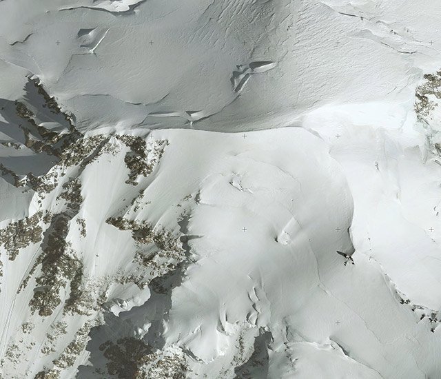
Aerial photography for aerial photogrammetry surveys and mapping

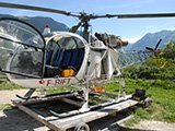
Sintégra has over 60 years experience in aerial topography and mapping surveys. Consequently, we are fully equipped to handle your aerial photography projects while delivering the best, most cost-effective technical solutions. Thanks to our highly qualified teams of engineers, technicians, and pilots specialized in aerial photography, all flight plans are carefully prepared so as to guarantee the highest quality and accuracy service while keeping costs under control.

Our company works in France and abroad (Europe, Africa, Middle-East, Indian Ocean…). It has the expertise and skills to process the collected data right through to delivering the final product.

We guarantee fast delivery of aerial photogrammetry surveys thanks to the fact that we have several types of cameras that can be fitted on all types of aircraft (planes, helicopter, drones), for vertical or oblique photography. We are equipped to operate efficiently whatever the region, the site topography, the surface area to cover and the desired resolution.

For complex projects which require several techniques (photogrammetry, Lidar, bathymetry…), Sintégra is your unique, multi-skilled partner. We are equipped to efficiently and quickly provide solutions to all your needs.

Aerial photography applications

The aerial photographs produced by our surveying company are generally used to create orthophotomaps and photogrammetry maps. They are also commonly used to produce 3D models and for communication purposes.

There are many applications including:

  • A comprehensive overview of a territory:
    • Land management through creation and updating of a GIS (Geographic Information System).
  • Hydrolography and dams:
    • Preliminary impact studies,
    • Volume calculations, measuring hydraulic head,
    • Rising water level simulations,
    • Catchment calculations, runoff…
  • Quarries and mines:
    • Site monitoring,
    • Volume calculations,
    • Site rehabilitation…
  • Environmental studies:
    • Ecological impact of a project,
    • Land use planning,
    • Emergency surveying…
  • Forestry and agriculture:
    • Irrigation field,
    • Forest inventory…
  • Infrastructure studies:
    • Land use planning:
      • Civil engineering,
      • Building and Public Works,
      • architecture,
      • Urban planning…
    • Transportation:
      • Road,
      • Rail,
      • River…
    • Energy transportation, power lines,
    • Pipelines,
    • Fiber optic installation…
  • Natural hazards:
    • Flood risk mapping,
    • Site surveillance (landslides, erosion…),
    • Gravitational hazards (rockfalls, trajectography),
    • Avalanche risk mapping,
    • Glacier monitoring…
  • 3D model texturing and coloring tool
  • Status archiving:
    • To preserve a legally enforceable record of a status,
    • Assessment after a major event (natural catastrophe…).

Technical resources and equipment

We are equipped to deploy our sensors on all types of aerial survey aircraft:

  • Single engine (Cessna 206TU) or twin engine (Beechcraft 200, Beechcraft 90, Partenavia P68C) aircrafts
  • Helicopters
  • Rotary wing UAVs (Terradrone, DJI) or fixed wing UAVs (eBee)
  • Large format cameras (Z/I DMC and DMCII)
  • Medium format cameras (Leica RCD30, Hasselblad and Phase One)

The pictures can be acquired in natural color (RGB) or in near infrared (NIR). Thanks to our equipment, we are flexible and can deliver optimal customized solutions with fast turnaround times. The use of acquisition systems consisting of equipment (hardware and software) integrated in-house gives us great autonomy in the field in case of unforeseen events.

references

National Forestry Service – Chartreuse Mountains

Isère (France)


Aerial stereo photographs RGB and CIR at 10 cm/pixel (simultaneously with a LiDAR survey) over 124 km². Orthophotography by autocorrelation for a National Forestry Service project – Isère agency – IRSTEA (forestry and archeological studies).

Auvergne-Rhône-Alpes Regional Geographic Information Center – Saint-Etienne

Loire (France)


Aerial stereo photographs at 5cm resolution with DMCII camera over 754 km². High overlap rate to limit the leaning of the buildings. High resolution orthophotography to create a base map for underground utilities operators.

Panav

Congo river and Kasaï river (Democratic Republic of Congo)


Aerial stereo photographs at 20 cm/pixel RGB and CIR (simultaneously with a LiDAR survey) over 2 340 km and 17 700 km² for a project on the navigability of Waterways and Lacustrine zones.

Greater Bordeaux

Gironde (France)


Aerial stereo photographs vertical RGB at 10 cm/pixel with DMCII (simultaneously with a LIDAR survey) and oblique at 5 cm/pixel with the City Mapper system over 620 km² – High resolution Orthophotography for updating GIS.