Knowledge of the morphology of the sea floor is especially important for engineering or project management firms specialized in hydraulic developments and the operators, local authorities, and concession holders responsible for managing waterways, bodies of water, and quarries and ensuring the safety of people and property in case of flooding or high water.
Digital terrain models (DTM) or profiles are used to produce different types of 2D and 3D documents, which are used in a wide range of applications:
- Morphological studies of the underwater topography:
- Variation in morphology depending on floods,
- Transportation of materials,
- Navigation sizing,
- Overseeing dredging and scouring of port facilities,
- Volume measurements,
- Detection of shipwrecks, obstruction or damming.
- Locks and river banks:
- Minor or major bed profiles,
- Erosion monitoring and protection,
- Flood risk prevention assessments.
- Environmental studies:
- Mapping data for protection of sensitive environments.
Technical resources
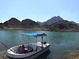
Our field teams are highly experienced and accredited to perform hydrographic survey services. Our company has its own motorized boats (rigid or flexible hulled boats) and can also locally charter a boat that is specifically tailored to the site’s navigation constraints.
We have several types of echosounders:
- Single beam single frequency (Tritech PA500) for shallow depths (from 30m to 50m), presented as profiles.
- Single beam dual frequency (ODOM MKIII) for deep water surveys (up to 1500 m), or when the alluvial layer is thick.
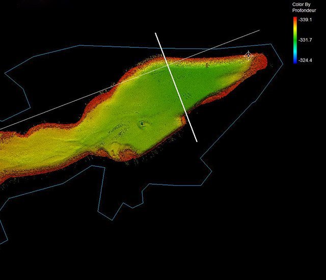
- Multibeam system Reson T20-P for surveys presented as dense continuous surface models which can be combined with sonar imagery
The topography of banks and dry land zones (islands, banks, rocky outcrops…) can be surveyed using airborne or boat-embedded dynamic lidar, coupled with a multibeam system. Local aerial mapping by drone is also possible.
The trajectography of our echosounders is determined in real time using differential GNSS georeferencing with centimetric accuracy. Navigation and probe calculations are performed with specific software (Hypack et Hysweep).
Our company has obtained the French MASE (manual for the improvement of company safety) certification, required for certain sectors of activity and principals such as EDF (the French electricity company).
Deliverables:
- Maps with isobath curves
- Point cloud or predefined grid
- Profile
- Volume measurement