Depending on the issue to be monitored on the site or structure (kinematic and importance of displacements), Sintégra is equipped to implement periodic or continual monitoring by automated remote monitoring.
Thanks to automated real-time tracking, monitoring ensures that measurements are taken at regular intervals. This provides decision making assistance when the site is being secured. Warnings can be generated when displacements observed exceed pre-determined thresholds.
Geotechnical and structural monitoring is used in a very wide range of contexts:
- Industrial and scientific environments:
- Verification of bridge cranes,
- Monitoring deformations of transfer slabs for nuclear submarines,
- Adjustments of optical benches and machine tools,
- Verification of various supporting structures,
- Verification of alignment of electromagnets on particle accelerators,
- Dimensional control of large sized parts.
- Monitoring structures and civil engineering work:
- Stability inspection:
- Viaduct, bridge,
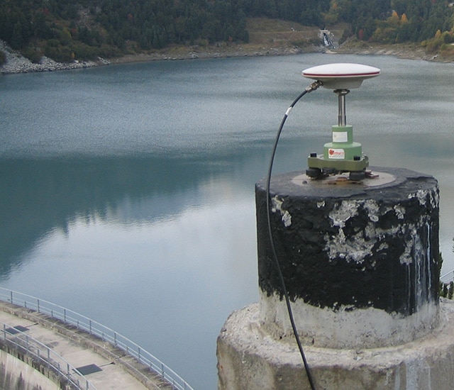
- Dam, dikes,
- Tunnel, gallery,
- Various reinforcements or buttresses.
- Size inspection on roads:
- Tunnel, gallery,
- Crossing structure, overpasses, underpasses.
- Natural hazards:
- Monitoring large natural landslides.
- Stability inspection of high risk zones:
- Railway embankments,
- Rock cliffs,
- Rockfills…
Staff and resources
Our specialized staff has specific accreditations to work in a wide range of environments on multiple projects including:
- Radioactive environments,
- Confined environments,
- Work at height,
- Rope access work…
Our company has obtained the French MASE (manual for the improvement of company safety) certification, ensuring that the HSE (Health, Safety and Environment) procedures will be specifically adapted to the needs of each site.
Sintégra has its own geotechnical and structural monitoring equipment:
- High accuracy total stations,
- Dynamic and static laser scanners,
- Highly accurate digital levels,
- GNSS receivers.
Our monitoring systems are controlled by the GeoMoS (Leica) multi-site and multi-sensor platform allowing configuration, on-line publishing of results and triggering alerts.