High-precision cartography for the Swiss territory
In 2022, the Swiss Federal Office of Topography, swisstopo, has launched a vast campaign to collect topographic data throughout the country. The aim is to produce a cloud of classified points, as well as digital terrain models (DTMs) and surface models (DSMs) based on high-precision LiDAR data. SINTEGRA was chosen to carry out all the necessary acquisitions and processing over an area of almost 7691 km², covering the cantons of Basel-Stadt, Basel-Landschaft, Solothurn and Bern, as well as a buffer zone.
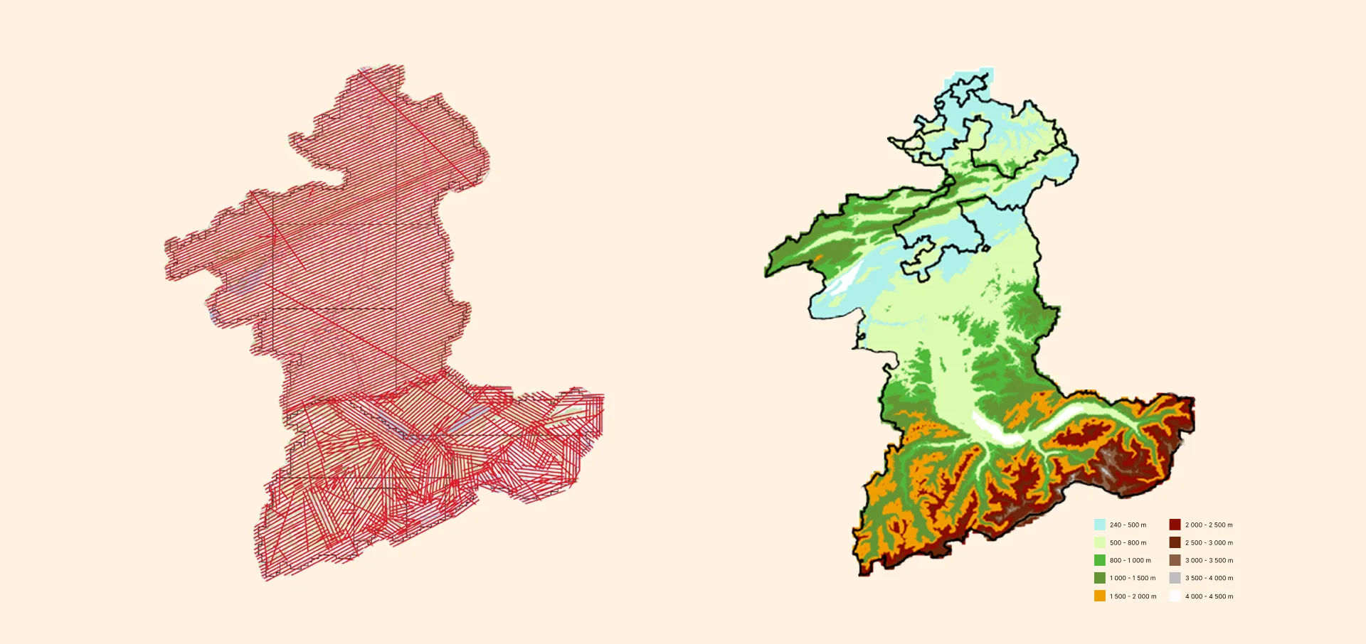
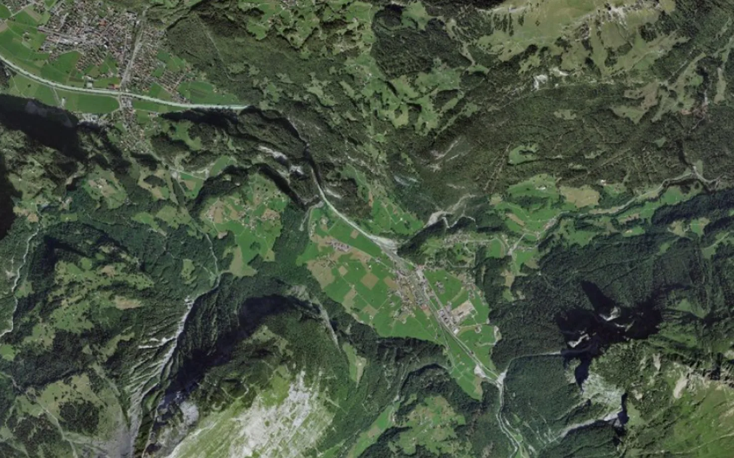
Flight plan of the swisstopo project entrusted to SINTEGRA and height distribution
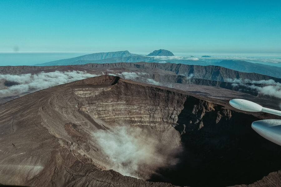
A technical challenge: between high mountains, weather and seasonal constraints
The mission entrusted to us proved particularly demanding. Spanning three years (2022 to 2024), it had to comply with two major constraints: the flights had to take place outside the foliage period and without snow cover. This was essential to guarantee optimum survey quality, but also complicated the logistics: weather availability, restricted shooting windows, high-altitude flights over varied terrain.
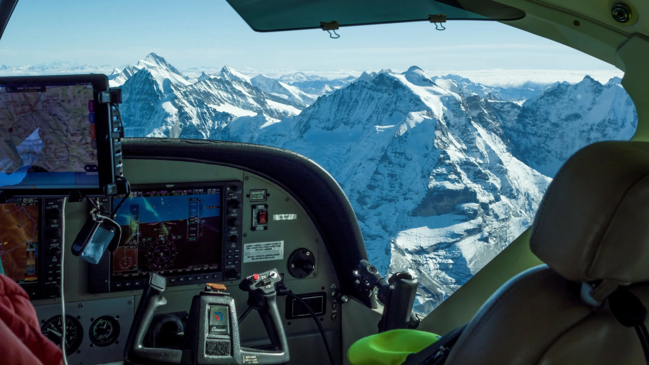
We therefore divided the acquisition into multiple flight sessions, carried out with different aircraft (C208, P68, etc.) equipped with Riegl VQ780IIS sensors for LiDAR and PhaseOne iXU-RS for photography. A total of 88 flight hours were required to complete the coverage.
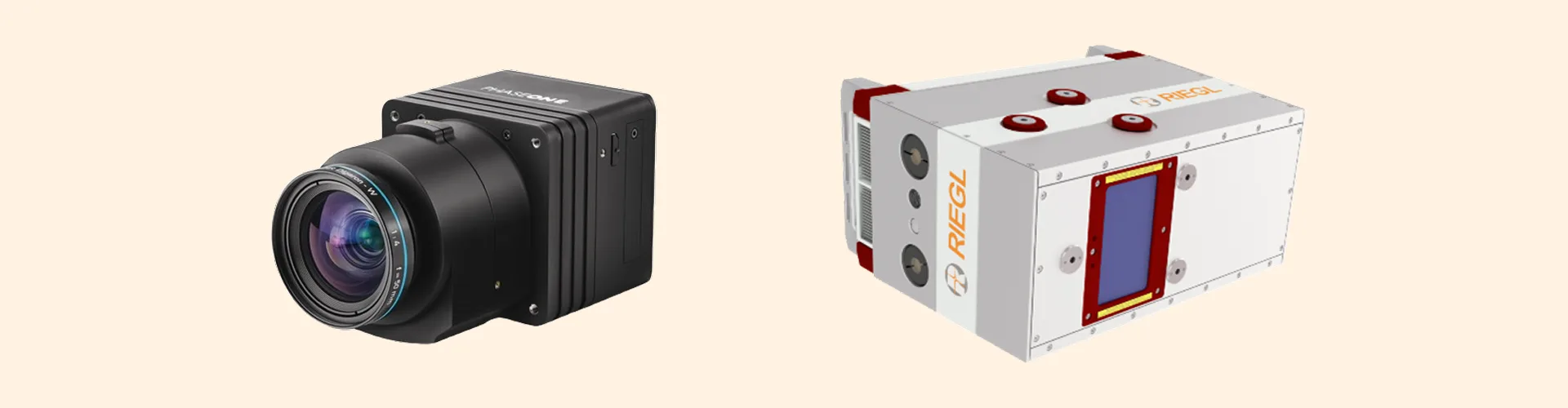
PhaseOne iXU-RS photo sensor and Riegl VQ780IIS LiDAR sensor
LiDAR data treated with rigor: AI, manual control and centimeter accuracy
In addition to acquisition, we implemented a complete LiDAR processing process: GNSS and inertial trajectory calculation, point seed generation, inter-band adjustment and classification.
This hybrid approach enabled us to leverage the power of the TerraSolid software suite for the first zones, then theartificial intelligence developed with GEOFIT to automate the classification for the following zones. The result: seedbeds classified into 9 thematic classes, ranging from soils and buildings to vegetation, bridges and high-voltage lines.
Each classification was then checked manually: our operators verified and corrected any errors, using tools such as the hypsometric TIN for the ground class. This dual control – machine and human – enabled us to achieve an average vertical accuracy of 2.6 cm, validated by GNSS measurements on the ground.

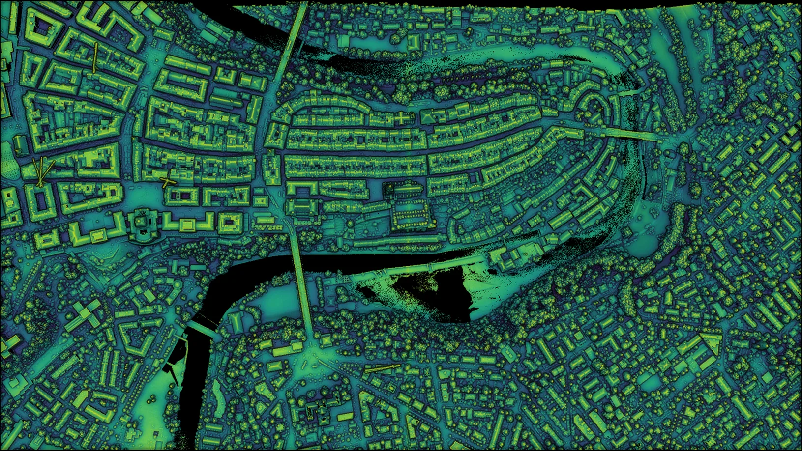
City of Bern with RGB orthophoto view, then MNS
A masterful technical patchwork: between know-how and operational excellence
One of the greatest technical challenges wasinter-band adjustment, made complex by the staggered duration of the acquisition and the variability of the terrain. From one month to the next, morphology could change radically, particularly in the high mountains. We met this challenge by integrating precise vector layers (roads, paths, buildings) into our algorithms, and by concentrating the adjustment on stable zones, free of vegetation or snow.
At the same time, we produced a technical orthophoto from RGB images orthorectified on the LiDAR DTM, with a ground resolution of 20 cm. This product, both visual and metric, complements the digital models to provide a comprehensive representation of the terrain.
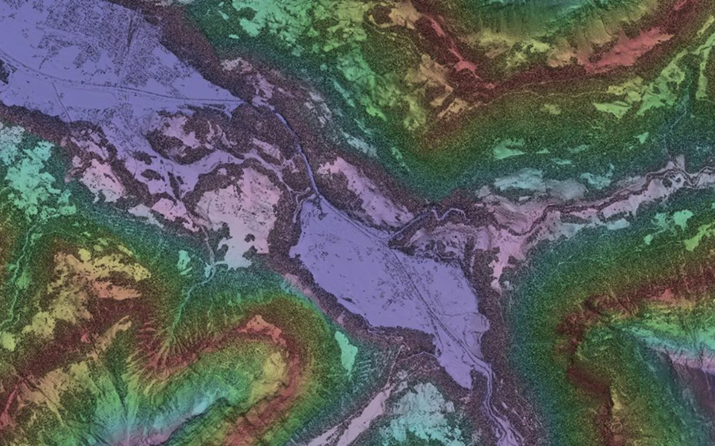
MNS fading with hypsometric staining
Complete deliverables for satisfied customers
Nous avons livré l’ensemble des produits attendus par swisstopo, tous conformes aux spécifications :
- Semis de points LiDAR classifiés
- Modèles numériques de terrain (MNT) et de surface (MNS) à 50 cm
- Cartes de densité et de lacunes, zones enneigées
- Orthophotos techniques
- Trajectoires et emprises de vol
Ces livrables ont été validés progressivement, zone par zone, tout au long de l’avancement du projet. Grâce à notre chaîne de production intégrée et notre expérience en milieux complexes, nous avons pu garantir un haut niveau de qualité, reconnu par la satisfaction finale du client.
Ce projet marque une nouvelle étape dans notre développement européen dans le domaine des levés aériens et du traitement de données LiDAR. Pour toutes nos équipes mobilisées – acquisition, photo, LiDAR, topographie –, cette mission constitue une référence, illustrant notre capacité à mener à bien des opérations exigeantes avec rigueur et efficacité.
Ce succès ouvre la voie à de nouvelles perspectives, en Suisse comme ailleurs, où la précision, la fiabilité et la capacité d’adaptation sont les clés d’un territoire intelligemment cartographié.
Les données utilisées sont gratuites et librement accessibles dans la section de téléchargement du portail swissSURFACE3D. Enfin, les modèles de surface et de terrain sont également visualisables sur le géoportail de la Confédération : https://s.geo.admin.ch/43mbu73rny95.