Topographic Survey Services
Definition Topographical survey

Topographical survey definition

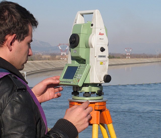
A topographical survey consists in collecting data in the field to deliver a representation at the desired scale in the form of a topographical map. In order to do this, a three dimensional coordinate system must be established in which the object or the land surveyed shall be represented. Different, complementary acquisition means can be used for the purposes of terrestrial topography: tacheometers, GNSS sensors, static or mobile laser scanners, cameras, echosounders…

Land based topographic survey and mapping services

Our company provides topographic survey services that are adapted to all types of land use planning projects as well as answering the specific needs of:

  • Local Authorities,
  • Engineering firms,
  • Operators of road infrastructures, industrial and utility companies,
  • Architects and urban planners,
  • Promoters and real-estate developers.

To deliver this type of service, we have the resources to deploy several experienced, multidisciplinary teams at once. We deliver optimal solutions fast and to deadline.

Our head office and 3 agencies are located in the Grenoble region and we have in-depth knowledge of local issues which invariably come up when a topographical survey is needed.

In addition, our company regularly works all over France and abroad. We can deliver topographic services worldwide and we adapt our solutions to your needs.

The georeferencing of our topographical maps is state-of-the-art, in compliance with regulations pertaining to work carried out on behalf of the Government and Local Authorities and to affiliation with French geodesic reference systems.

For complex projects, the company has the expertise to combine its skills in ground surveys with aerial mapping techniques such as photogrammetry or airborne Lidar (by plane, helicopter or drone).

Topographical survey applications

A topographical map, whether in 2D or 3D, is the essential preliminary support required for any land use planning or infrastructure study, in the form of an assessment of terrain or the body of a street including all its characteristics (natural terrain, built, streets, visible utilities, urban furniture and any other noticeable elements).

  • Land use planning assessments:
    • As-built plans of streets and underground utilities, before and after work,
    • Road, highway, rail surveys,
    • Simplified street map,
    • Preliminary land use planning assessment…
  • Urban and architectural projects:
    • Topographical map with altimetry and existing utilities,
    • Interior plans, walls and cross-sections,
    • Surface areas and volumes,
    • 3D city models…
  • Energy transportation and telecommunications:
    • As-built plans before implantation of a new network (fiber optic, pipeline, electricity, gas…),
    • As-built plans after work, open or closed-cut, with detection…
  • Hydrological studies:
    • Hydrographic maps with isobath curves,
    • Profile and cross-section views,
    • Surface models of bottoms and banks,
    • Scouring and dredging monitoring (volumes)…
  • Various production site maps:
    • Blueprints with on-site equipment,
    • 3D digital modeling,
    • Quarry maps,
    • Various production sites…

Equipment and resources

We have the capacity to deploy several teams of experienced technicians and engineers simultaneously, working on one or more projects at once. Consequently, we deliver solutions fast and efficiently. Our teams have all the equipment needed to deliver classic terrestrial topographic surveys (tachometers and GNSS systems) as well as the tools needed to answer more specialized requests.

For the same project, other surveying techniques may be used such as:

In addition, aerial surveying techniques can be used (photogrammetry, lidar, etc.) to complete terrestrial data which may not be sufficiently comprehensive.

références

APRR / EGIS – Autoroute A75

Puy-de-Dôme (France)


Plan topographique au 1/1000 sur 12 km – Compléments terrestres à des levés photogrammétriques aériens et lasergrammétriques par road scanning – Plan de récolement des ouvrages enterrés  pour études d’élargissement.

SNCF / SETEC – Ligne St-Gervais à Vallorcine

Haute Savoie (France)


Plan topographique au 1/200 des 10 gares de la ligne pour étude de modernisation de la ligne « Mont-Blanc Express ».

SM3A – Rivières de l’Arve – Le Giffre – Le Borne

Haute Savoie (France)


Plans topographiques au 1/200 ou 1/500 de type hydraulique – Vues en plan avec profils en travers et en long – Compléments bathymétriques et levés d’ouvrages pour études techniques.

Métropole de Grenoble / Régie assainissement

Isère (France)


Plans topographiques sur 22 communes de type corps de rue avec récolement des réseaux aériens et enterrés – Levé de réseaux pour études techniques avant travaux et intégration au SIG.