Land Development Study
Definition Land Development Study

Land development definition

Land development includes procedures designed to guarantee the development and appropriate use of a territory. In France, only land surveyors accredited by the Minister of Agriculture may be designated to execute land development operations.

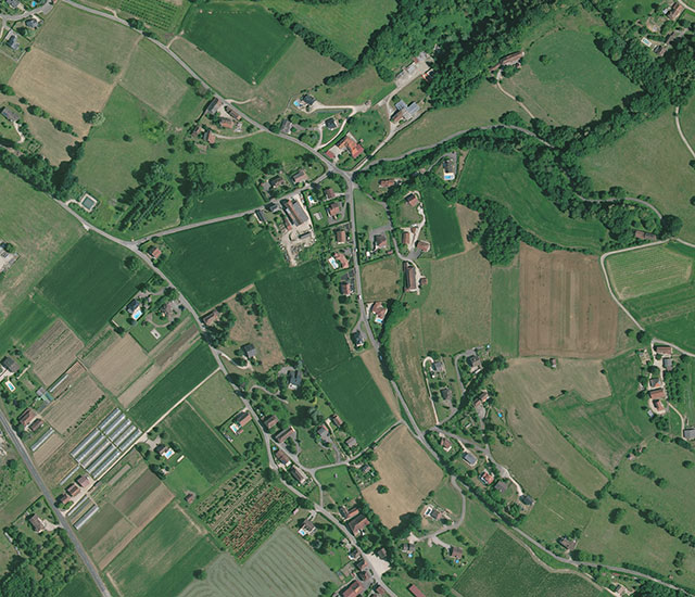
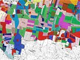
Land Development Studies & Mapping Services

Sintégra chartered land surveying company is fully accredited to deliver rural, agricultural and urban (real-estate, etc.) land development studies and services.

Land development is no longer limited to land redistribution: it is also dedicated to improving the operating conditions of agricultural properties, to optimizing natural spaces, and municipal or inter-municipal land use planning with a continual focus on respecting the environment.

With our teams of skilled, experienced engineers and chartered land surveyors, our company can assist you with all your projects no matter how complex. Depending on your needs, we can assist you on one phase of the project or manage it fully, from the draft stage to work acceptance.

We have the expertise to efficiently handle the different procedures related to land development, such as parceling for agricultural, forestry and environmental purposes (known as AFAFE in France).

As chartered land surveyors, we play a key role on this type of project and we work in collaboration with all stakeholders including local authorities, commissions, and owners. Our firm can also provide project management consultancy for your land development projects.

Land development applications

Our chartered land surveying company delivers land development services to County Councils. Services include:

  • Land Development Preliminary Studies related or not to linear works projects,
  • Land parceling for agricultural, forestry and environmental purposes:
    • Traditional
    • Related to linear works
    • Voluntary sale and transfer of rural or forestry buildings


In addition our expertise in land development includes negotiating your acquisitions and handling administrative issues for public utility projects engaged by any type of actor:

  • Local Authorities
  • Public actors (work or equipment trade organizations, etc.)
  • Private actors (highway company, etc.)


Sintégra works with contracting authorities at all land development project levels:

  • Topographical maps and orthophotomaps
  • Land plot enquiries:
    • Plot maps and plot assessments,
    • Public enquiry management: prefectural decrees, owner notifications, staking out boundaries…
  • Land negotiation for:
    • Acquisitions,
    • Temporary usage,
    • Operator evictions…
  • Project management assistance:
    • Compensation protocols,
    • Expertise of agricultural holdings,
    • Expropriation procedures…

Resources implemented

Our company’s Land Development department relies on all our resources:

  • Chartered land surveyors, including a land development specialist and member of the “Land Development” Ordinal Commission,
  • Engineers with wide-ranging expertise,
  • Technicians specialized in land development, land work, topography and photogrammetry.

Thanks to the comprehensive skills of our extensive team, we deliver premium quality services and fast turnaround times to deadline.

references

APRR – A71-A6-A71/RN79-A75 – Land negotiator for work programs

A71 – Montée des Volcans (63)

A6 – Widening of Auxerre (89)

A71 / RN79 – Hub of Montmarault (03)

A75 – Widening of Clermont-Ferrand Est / Le Crest (63)


Land negotiator for work programs – Negotiation of acquisitions and case management.

Caderousse, Mornas, Orange and Piolenc – New Méditerranée High Speed Train

Vaucluse / Plaine d’Orange (France)


Land parceling related to a linear work with exclusion of right-of-way – Exclusion: 2020 ha-Study to resolve and/or diminish the impacts of the work by organizing properties and operations.

Chamaloc

Drôme (France)


Land Use Preliminary Study on 2 000 ha for land development preliminary studies – Agricultural and forestry issues.

Anneyron – Deviation of Departmental Road n°1

Drôme (France)


Land parceling related to a linear work with inclusion of right-of-way + Divison of land on a right-of-way of 2 500 ha – Study to resolve and/or diminish the impacts of the work by reorganizing properties and operations.

Alixan – Deviation of Departmental Road 538

Drôme (France)


Land Use Preliminary Study on 2 500 ha for land development preliminary studies.