Sintégra - International company for topography, surveying, mapping, 3D modeling
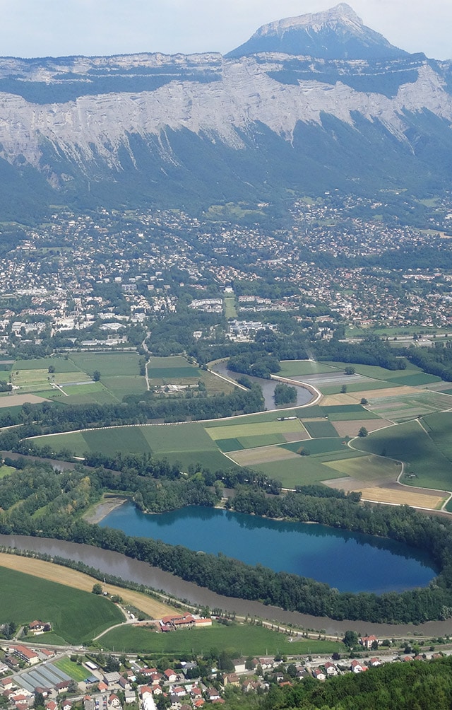
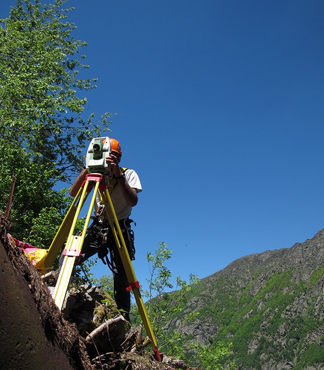
Our topographic surveying and mapping company delivers state-of-the-art, innovative services in the fields of terrestrial topography and aerial mapping by photogrammetry, implementing the more recent technologies such as lidar, mobile mapping, bathymetry, drones, 3D city models and BIM.
land surveys and urban development assessments related to your projects.
In 1954 André Mémier created a chartered land surveying company and began developing photogrammetry services in 1961. Sintégra carried on this activity initially as an economic interest grouping (1971) and later as a company starting in 1987. Today, it is the oldest private French photogrammetry company. In 2006 our company was the first in France to offer airborne lidar services. At the same time, the company continued to expand its footprint in Grenoble and in the Auvergne-Rhone-Alpes region:
- 2004 : it took over the chartered surveying company, CHALON (Voiron, Isère)
- 2009 : it operated a merger with the CTGE chartered surveying company (Domène, Isère)
- 2011 : it took over the chartered surveying company, MOURARET (St-Marcellin, Isère)
- 2011 : it operated a merger with the engineering office, ARTIGEO (Vinay, Isère)
Expertise
While continuing to develop our chartered land surveying expertise, our company and our chartered surveyors and topographers are innovating in the fields of topography and photogrammetry, while integrating new technologies such as:
- Lidar
- Mobile mapping
- Bathymetry
- Drone
- 3D models
- BIM…
Over the years, thanks to our multiple skills, we have provided support and advice to a wide range of clients including local authorities and land use planning stakeholders, individuals and promoters, engineering firms, architects, industrial and scientific sites, among others.
Environment, health and safety (ehs) approach
To answer the needs of our customers for high quality measurements and interpretation, our quality approach is based on a continual improvement process which has been certified in compliance with the 2015 ISO 9001 standard as of February 2018.
As part of our commitment to ensuring the highest health, safety and environmental standards we have implemented the French MASE (manual for the improvement of company safety), for which we have been certified for the past 3 years.
sintégra
Head Office: Meylan (Grenoble)
Urban development
Terrestrial surveys
Mobile mapping
Aerial and drone surveys
3D Modeling
Sintégra
Sintégra is involved in many professional or academic organizations to help showcase and promote our profession, as well as helping train actors concerned:
- SNEPPIM (National organization of private photogrammetry and metric imagery companies)
- APGTP (Joint association of surveyors, topographers and photogrammetry experts)
- OGE (National association of chartered surveyors)
- UNGE (National union of chartered land surveyors)
- AFT (French association of topography)
- SFPT (French society of photogrammetry and remote sensing)
- Polytech