We offer cartographic production services tailored to your needs, guaranteeing accuracy and reliability to anticipate the most sensitive situations:
Environmental studies & risks
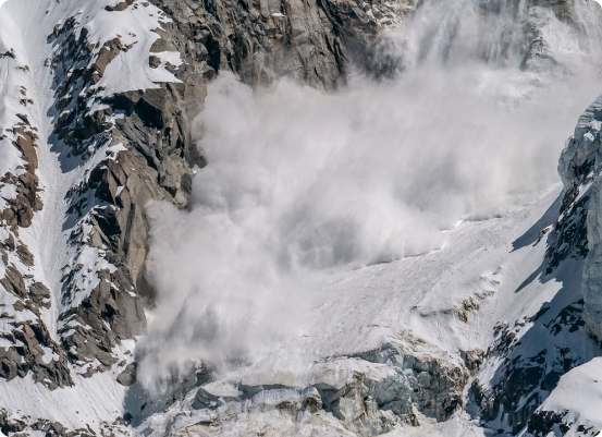
SINTEGRA carries out environmental and natural risk management studies (floods, landslides, avalanches). Our tools enable us to produce accurate maps and terrain models for risk prevention and management, particularly in the face of the challenges posed by climate change. The data collected is crucial to ensuring the safety of projects and exposed areas.
- Flood studies: Flood zone mapping and risk modeling to anticipate floods and protect infrastructures.
- Landslide studies: analysis of slopes and soils to identify areas at risk.
- Avalanche studies: Avalanche risk assessment in mountainous areas.
SINTEGRA is committed to continuous improvement, developing tools and processes to meet the evolving needs of geolocation data production.
Our strengths
GEOFIT, maison mère de SINTEGRA, investit dans l’intelligence artificielle pour améliorer nos chaînes de production. Cette approche nous permet d’exploiter efficacement les images satellitaires, aériennes et terrestres pour fournir des informations géospatiales de haute qualité.
Des décennies d’acquisition de données permettent à nos équipes d’entraîner rapidement et efficacement de nouveaux modèles d’apprentissage automatique.
Our expertise
With over 70 years of expertise, SINTEGRA is a versatile player, pioneering LiDAR in France. Thanks to our mastery of technologies, we can offer solutions tailored to your local and international needs.
