BIM services (Business Information Modeling)
Definition BIM

BIM definition

BIM or Building Information Modeling is a work method used to generate and manage data about a building, a structure or an industrial installation from lifecycle start to finish. This model is designed to allow the different stakeholders involved (architects, design offices, project managers…) to share, modify or enrich data throughout all the phases of creating or rehabilitating a structure.

Building Information Modeling (BIM) Services for architecture, industrial and civil engineering

Sintégra chartered surveying company provides as-built BIM services such as a structured, detailed digital model of a building or infrastructure which represents its physical reality and is designed to be used collaboratively by all project stakeholders.

We use a wide range of skills to execute the 3D surveys needed to deliver BIM services:


Using these production means, our company is equipped to deliver a BIM model that can be enriched with specific attributes by the different stakeholders involved in your project.

For as-built project requirements, our specialists provide extremely accurate, high quality information and deliverables. The different LOD (Levels of Detail) of the model can be developed: from LOD 100 (basic) to LOD 500 (as-built).

With our extensive experience in virtual 3D modeling of buildings, historic and cultural heritage sites, and various structures or infrastructures, we have advanced expertise in BIM.

BIM applications

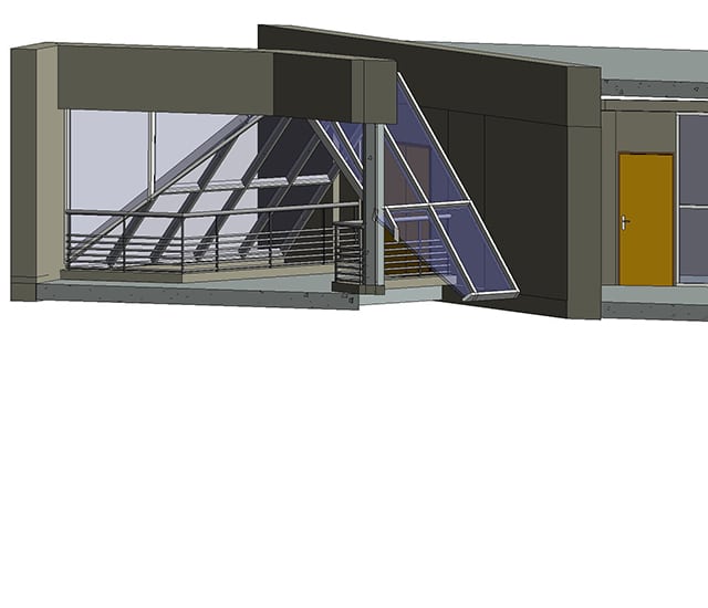
As respected land-use planning professionals, with in-depth expertise of the comprehensive range of legal and technical issues, our chartered land surveyors play a key role in creating as-built BIM models.

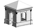
  • Heritage sites and archeology:
    • Mapping results/current situation,
    • Structural plans,
    • Framework plans,
    • Interior plans, cross-sections and facades,
    • Morphology…
  • Civil and structural engineering:
    • Dam,
    • Tunnel,
    • Viaduct and bridge.
  • Various buildings:
    • Offices,
    • Shops,
    • Community infrastructures…

Resources implemented

Sintégra owns all the equipment needed to deliver aerial and terrestrial 3D surveys:

  • Equipment (lidars, cameras, tacheometers…)
  • Aircrafts (drone/helicopter/airplane.)
  • 3D modeling and data processing softwares (3DS/MAYA/RHINO/REVIT…)

Our teams include graphic artists specialized in 3D modeling. The BIM digital model is made using specialized software such as Autodesk Revit.

In addition to the standard IFC format, which guarantees interoperability between the different softwares, other CAD formats can be delivered:

  • Solidworks
  • PDMS
  • SmartPlant
  • Autocad
  • Microstation…

références

SFTRF – Viaduc du Fourneaux

Savoie (France)


Modélisation 3D TQC à partir de données lasergrammétriques, classification BIM de type génie civil, étude de réhabilitation.

Ville de Valence – Pendentif

Drome (France)


Modélisation 3D TQC haute résolution à partir de données lasergrammétriques du monument funéraire classé et datant de la renaissance, orthophotoplan des façades à 5 mm/pixel, étude patrimoniale, archivage numérique.